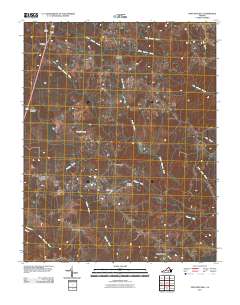
2011 Map of Fort Mitchell
USGS Topo · Published 2011About this map
The Middle Meherrin River and South Meherrin River anchor this rural landscape, carving a network of drainage basins through Lunenburg County. Small crossroads settlements and historic family landmarks define the human geography, with Plantersville and Fort Mitchell serving as central points for local transit. The map documents a sparse but deliberate settlement pattern, where hamlets like Blevins Corner and Five Forks occupy higher ground between the numerous creek branches.
Find a feature on this map
23 named features on this map. Tap any name to fly to it.
Don’t see what you’re looking for? This feature index may not catch every label — zoom into the map to look around manually.
Map Details
Editions of this 2011 Fort Mitchell Map
This is the sole edition of this map. No revisions or reprints were ever made.
Other maps of this area

1891 · Farmville
USGS Topo · 1:125,000

1892 · Appomattox
USGS Topo · 1:125,000

1893 · Farmville
USGS Topo · 1:125,000

1947 · Roanoke
USGS Topo · 1:250,000

1953 · Greensboro
USGS Topo · 1:250,000

1954 · Greensboro
USGS Topo · 1:250,000

1954 · Clover
USGS Topo · 1:62,500

1955 · Chase City
USGS Topo · 1:62,500

1956 · Charlotte Court House
USGS Topo · 1:62,500

1958 · Keysville
USGS Topo · 1:62,500