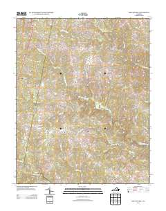
2013 Map of Fort Mitchell
USGS Topo · Published 2013About this map
The Middle Meherrin River and its numerous tributaries, including Crupper Run and Mitchell Cr, define the drainage patterns of this rural Lunenburg County landscape. Small crossroads settlements like Fort Mitchell and Plantersville anchor the local road network, which is composed of historic routes such as Old Kings Rd and Plantersville Rd. The map reveals a highly dispersed settlement pattern typical of Southside Virginia, where agriculture and forestry follow the winding creek beds of Big Juniper Cr and Little Juniper Cr. Significant water features like Sneads Pond and the confluence leading toward the S Meherrin River near Finneywood illustrate the area's reliance on these natural boundaries for land division and transport. This 2013 survey provides a clear view of the modern rural infrastructure, from the bypass at Ontario to the quiet junctions at Kells Corner and Five Forks.
Find a feature on this map
72 named features on this map. Tap any name to fly to it.
Don’t see what you’re looking for? This feature index may not catch every label — zoom into the map to look around manually.
Map Details
Editions of this 2013 Fort Mitchell Map
This is the sole edition of this map. No revisions or reprints were ever made.
Other maps of this area

1891 · Farmville
USGS Topo · 1:125,000

1892 · Appomattox
USGS Topo · 1:125,000

1893 · Farmville
USGS Topo · 1:125,000

1947 · Roanoke
USGS Topo · 1:250,000

1953 · Greensboro
USGS Topo · 1:250,000

1954 · Greensboro
USGS Topo · 1:250,000

1954 · Clover
USGS Topo · 1:62,500

1955 · Chase City
USGS Topo · 1:62,500

1956 · Charlotte Court House
USGS Topo · 1:62,500

1958 · Keysville
USGS Topo · 1:62,500