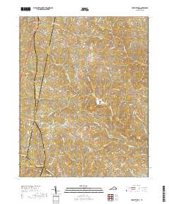
2019 Map of Fort Mitchell
USGS Topo · Published 2019About this map
The confluence of the Meherrin River and its major tributaries, including the South Meherrin River and Middle Meherrin River, defines the southern border of this landscape where Charlotte, Lunenburg, and Mecklenburg counties meet. This rural corridor is anchored by long-standing small settlements like Fort Mitchell, Plantersville, and Ontario, which are connected by a network of winding country roads such as Plantersville Rd and State Rte 719. Local family history is preserved at the Friendship Cem and Gregory Cem, reflecting the generations of residents who managed the land between Knights Cr and Cropper Run. The presence of Five Forks and numerous smaller crossings like the Newcomb Bridge Rd suggests an enduring pattern of travel centered on the river's forks and traditional creek-side homesteads.
Find a feature on this map
72 named features on this map. Tap any name to fly to it.
Don’t see what you’re looking for? This feature index may not catch every label — zoom into the map to look around manually.
Map Details
Editions of this 2019 Fort Mitchell Map
This is the sole edition of this map. No revisions or reprints were ever made.
Other maps of this area

1891 · Farmville
USGS Topo · 1:125,000

1892 · Appomattox
USGS Topo · 1:125,000

1893 · Farmville
USGS Topo · 1:125,000

1947 · Roanoke
USGS Topo · 1:250,000

1953 · Greensboro
USGS Topo · 1:250,000

1954 · Greensboro
USGS Topo · 1:250,000

1954 · Clover
USGS Topo · 1:62,500

1955 · Chase City
USGS Topo · 1:62,500

1956 · Charlotte Court House
USGS Topo · 1:62,500

1958 · Keysville
USGS Topo · 1:62,500