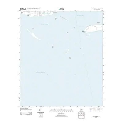
2011 Map of Fort Morgan
USGS Topo · Published 2011About this map
Fort Morgan and Fort Gaines stand as historic sentinels at the mouth of Mobile Bay, anchoring this coastal survey. This maritime landscape is defined by the shifting sands of the Dauphin Island Spit, Pelican Island, and Sand Island, showing the dynamic nature of the Alabama shoreline where the bay meets the Gulf of Mexico. The map documents the residential layout of Bienville Beach and Dauphin Beach, with local streets such as Epinet St and Buchanan St reaching toward the water. A critical transportation link is noted via the Dauphin Island-Fort Morgan Ferry Crossing, which connects the two historic fortifications across the channel. Notable landmarks for navigation and local recreation include the Front Range Light at Mobile Point and the Gulfside Golf Course, situated near the brackish waters of Alligator Lake and Oleander Pond.
Find a feature on this map
29 named features on this map. Tap any name to fly to it.
Don’t see what you’re looking for? This feature index may not catch every label — zoom into the map to look around manually.
Map Details
Editions of this 2011 Fort Morgan Map
This is the sole edition of this map. No revisions or reprints were ever made.
Other maps of this area

1921 · Point Clear
USGS Topo · 1:62,500

1921 · Dauphin Island
USGS Topo · 1:62,500

1921 · Delchamps
USGS Topo · 1:62,500

1941 · Cedar Point
USGS Topo · 1:62,500

1941 · Weeks Bay
USGS Topo · 1:62,500

1942 · Fort Morgan
USGS Topo · 1:62,500

1943 · Cedar Point
USGS Topo · 1:62,500

1943 · Weeks Bay
USGS Topo · 1:62,500

1953 · Mobile
USGS Topo · 1:250,000

1957 · Mobile
USGS Topo · 1:250,000