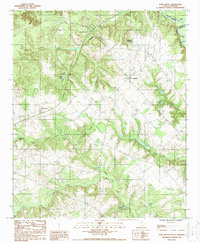
1987 Map of Fort Motte
USGS Topo · Published 1988About this map
Fort Motte serves as the central focal point of this South Carolina landscape, situated near the confluence where the Congaree River and Santee River meet. The geography is defined by a dense network of drainage systems, including Buckhead Creek, Halfway Swamp Creek, and Lyons Creek, which carve through the terrain and feed into numerous bodies of water like True Blue Lake and Wienges Lake. This late-1980s survey reflects a region still deeply tied to its historical land divisions and rural crossroads.
Find a feature on this map
21 named features on this map. Tap any name to fly to it.
Don’t see what you’re looking for? This feature index may not catch every label — zoom into the map to look around manually.
Map Details
Editions of this 1987 Fort Motte Map
This is the sole edition of this map. No revisions or reprints were ever made.
Other maps of this area

1943 · Eastover
USGS Topo · 1:62,500

1946 · Elloree
USGS Topo · 1:62,500

1946 · St. Matthews
USGS Topo · 1:62,500

1948 · Hopkins
USGS Topo · 1:62,500

1953 · Poinsett State Park
USGS Topo · 1:24,000

1953 · Gadsden
USGS Topo · 1:24,000

1953 · Wateree
USGS Topo · 1:24,000

1954 · Augusta
USGS Topo · 1:250,000

1957 · Augusta
USGS Topo · 1:250,000

1958 · Augusta
USGS Topo · 1:250,000