
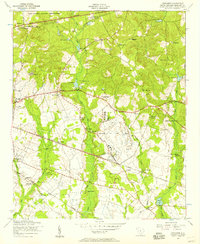
1953 Map of Gadsden
USGS Topo · Published 1957About this map
Congaree River floodplains dominate this 1950s landscape, where the meandering watercourse marks the boundary between Richland County and Calhoun County. The northern half of the sheet reveals a series of rural communities organized around the Southern railway line, particularly at Gadsden and Weston. This area is dense with community landmarks that provide significant value for genealogical research, including Mount Moriah Church, Zion Pilgrim Church, and Saint Mark Church.
Find a feature on this map
37 named features on this map. Tap any name to fly to it.
Don’t see what you’re looking for? This feature index may not catch every label — zoom into the map to look around manually.
Map Details
Editions of this 1953 Gadsden Map
This is the sole edition of this map. No revisions or reprints were ever made.
Other maps of this area

1943 · Eastover
USGS Topo · 1:62,500

1946 · Elloree
USGS Topo · 1:62,500

1946 · St. Matthews
USGS Topo · 1:62,500

1948 · Hopkins
USGS Topo · 1:62,500

1953 · Saylors Lake
USGS Topo · 1:24,000

1953 · Fort Jackson South
USGS Topo · 1:24,000

1953 · Eastover
USGS Topo · 1:24,000
1953 · Congaree
USGS Topo · 1:24,000

1953 · Wateree
USGS Topo · 1:24,000

1954 · Augusta
USGS Topo · 1:250,000