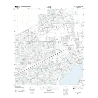
2012 Map of Fort Myers NW
USGS Topo · Published 2012About this map
The Caloosahatchee River forms the eastern boundary of this developed landscape, where the dense grid of Cape Coral meets the water. The suburban expansion is evident in the sprawling network of roads, including Del Prado Blvd and Diplomat Pkwy, while the area's nautical character is defined by the Paradise Yacht Club Marina and the Royal Palm Yacht Club Marina situated along the southern shoreline.
Find a feature on this map
93 named features on this map. Tap any name to fly to it.
Don’t see what you’re looking for? This feature index may not catch every label — zoom into the map to look around manually.
Map Details
Editions of this 2012 Fort Myers NW Map
This is the sole edition of this map. No revisions or reprints were ever made.
Other maps of this area

1956 · Punta Gorda SE
USGS Topo · 1:24,000

1956 · West Palm Beach
USGS Topo · 1:250,000

1956 · Tampa
USGS Topo · 1:250,000

1956 · Charlotte Harbor
USGS Topo · 1:250,000

1957 · West Palm Beach
USGS Topo · 1:250,000

1957 · Tuckers Corner
USGS Topo · 1:24,000

1957 · Gilchrist
USGS Topo · 1:24,000

1958 · West Palm Beach
USGS Topo · 1:250,000

1958 · Matlacha
USGS Topo · 1:24,000

1958 · Fort Myers NW
USGS Topo · 1:24,000
Featured Places
- Cape Coral, FL
- Fort Myers, FL
- North Fort Myers, FL
- Swan Lake Travel Trailer Park, FL
- Habitat for Humanity Housing, FL