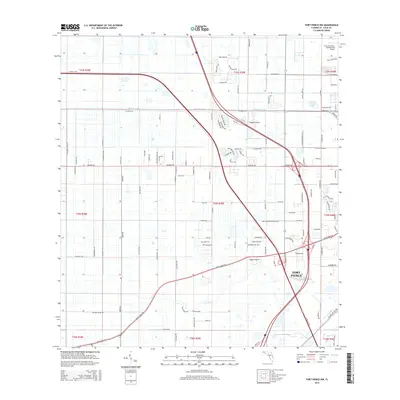
2015 Map of Fort Pierce NW
USGS Topo · Published 2015About this map
Fort Pierce serves as the focal point of this 2015 survey, illustrating the modern expansion of Saint Lucie County. The landscape is defined by a rigorous grid of agricultural and residential access roads, such as Orange Ave and Okeechobee Rd, which cut through former citrus groves and wetlands. Vital water management features like the Belcher Canal and Tenmile Cr demonstrate the engineering required to support the region's development. Transportation infrastructure is prominent, with the sweeping curves of Florida's Tpke bisecting the quadrangle and providing high-speed connectivity. The map also highlights significant institutional and aviation sites, including the St Lucie County International Airport, Baggett Airport, and the Pruitt Research Center Rd facility, reflecting the area's mix of research, commerce, and transit during the mid-2010s.
Find a feature on this map
54 named features on this map. Tap any name to fly to it.
Don’t see what you’re looking for? This feature index may not catch every label — zoom into the map to look around manually.
Map Details
Editions of this 2015 Fort Pierce NW Map
This is the sole edition of this map. No revisions or reprints were ever made.
Other maps of this area

1948 · Ankona
USGS Topo · 1:24,000

1948 · Indrio
USGS Topo · 1:24,000

1949 · Fort Pierce
USGS Topo · 1:24,000

1949 · Oslo
USGS Topo · 1:24,000

1949 · Fort Pierce NW
USGS Topo · 1:24,000

1950 · Ankona
USGS Topo · 1:24,000

1950 · Fort Pierce
USGS Topo · 1:24,000

1950 · Fort Pierce NW
USGS Topo · 1:24,000

1950 · Oslo
USGS Topo · 1:24,000

1950 · Indrio
USGS Topo · 1:24,000