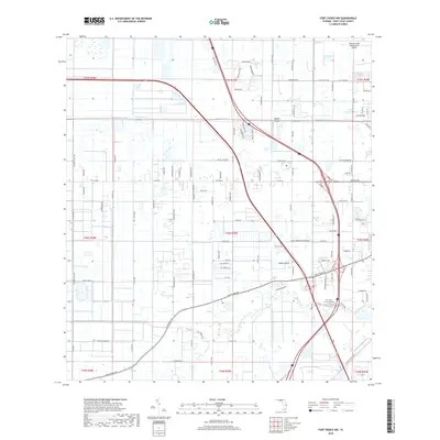
2018 Map of Fort Pierce NW
USGS Topo · Published 2018About this map
Tenmile Creek and the Belcher Canal anchor the drainage and transport system across this inland reach of Saint Lucie County. The landscape reflects a transition between agriculture and suburban expansion, dominated by a grid of named rural corridors such as Carlton Adams Rd and N Header Canal Rd. Public infrastructure and private aviation are significant features, with the expansive Treasure Coast International Airport and the smaller Baggett Airport providing transit hubs. The influence of local citrus production is etched into the land via the FTP Trail: Citrus Section, while water features like Clayton Howard Pond and the curiously named Bay of Pigs represent the specific local topography of this Florida interior. Major thoroughfares like Okeechobee Rd provide the primary east-west connectivity through the township and range sections.
Find a feature on this map
110 named features on this map. Tap any name to fly to it.
Don’t see what you’re looking for? This feature index may not catch every label — zoom into the map to look around manually.
Map Details
Editions of this 2018 Fort Pierce NW Map
This is the sole edition of this map. No revisions or reprints were ever made.
Other maps of this area

1948 · Ankona
USGS Topo · 1:24,000

1948 · Indrio
USGS Topo · 1:24,000

1949 · Fort Pierce
USGS Topo · 1:24,000

1949 · Oslo
USGS Topo · 1:24,000

1949 · Fort Pierce NW
USGS Topo · 1:24,000

1950 · Ankona
USGS Topo · 1:24,000

1950 · Fort Pierce
USGS Topo · 1:24,000

1950 · Fort Pierce NW
USGS Topo · 1:24,000

1950 · Oslo
USGS Topo · 1:24,000

1950 · Indrio
USGS Topo · 1:24,000