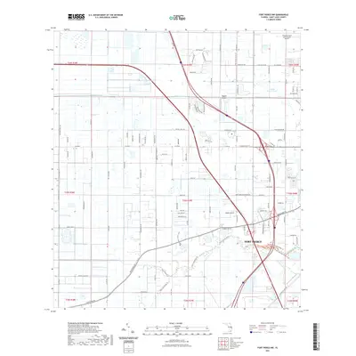
2021 Map of Fort Pierce NW
USGS Topo · Published 2021About this map
Fort Pierce serves as the focal point of this coastal Florida landscape, where a dense network of modern transportation corridors meets legacy agricultural drainage systems. The northern portion of the sheet is dominated by aviation and infrastructure, notably the Treasure Coast International Airport and the smaller Baggett Airport. The land is systematically partitioned by a grid of roads and drainage features such as the Belcher Canal and Tenmile Creek, reflecting a highly engineered coastal environment designed for both residential expansion and citrus farming. Local landmarks like Clayton Howard Pond and named routes such as Fort Pierce Farms Trl and Taylor Dairy Rd provide specific reference points for genealogists and local historians tracing the development of Saint Lucie County. This 2021 survey illustrates the contemporary balance between large-scale commercial facilities and the persistent rural-to-suburban transition typical of the Florida Atlantic coast.
Find a feature on this map
114 named features on this map. Tap any name to fly to it.
Don’t see what you’re looking for? This feature index may not catch every label — zoom into the map to look around manually.
Map Details
Editions of this 2021 Fort Pierce NW Map
This is the sole edition of this map. No revisions or reprints were ever made.
Other maps of this area

1948 · Ankona
USGS Topo · 1:24,000

1948 · Indrio
USGS Topo · 1:24,000

1949 · Fort Pierce
USGS Topo · 1:24,000

1949 · Oslo
USGS Topo · 1:24,000

1949 · Fort Pierce NW
USGS Topo · 1:24,000

1950 · Ankona
USGS Topo · 1:24,000

1950 · Fort Pierce
USGS Topo · 1:24,000

1950 · Fort Pierce NW
USGS Topo · 1:24,000

1950 · Oslo
USGS Topo · 1:24,000

1950 · Indrio
USGS Topo · 1:24,000