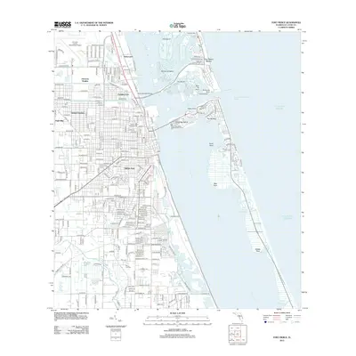
2012 Map of Fort Pierce
USGS Topo · Published 2012About this map
Saint Lucie and the northern reaches of White City anchor this coastal landscape, where the Atlantic shoreline meets the intricate waterways of the Indian River. The map reveals a highly structured residential grid expanding westward from the coast, including neighborhoods like Harmony Heights, Sunland Gardens, and Glidden Park. At the center of the maritime activity, the Banty Saunders Bridge crosses to the barrier islands, while the Fort Pierce Inlet provides essential passage for vessels navigating from the Atlantic Ocean into the protected cuts and coves.
Find a feature on this map
54 named features on this map. Tap any name to fly to it.
Don’t see what you’re looking for? This feature index may not catch every label — zoom into the map to look around manually.
Map Details
Editions of this 2012 Fort Pierce Map
This is the sole edition of this map. No revisions or reprints were ever made.
Other maps of this area

1948 · Ankona
USGS Topo · 1:24,000

1948 · Eden
USGS Topo · 1:24,000

1948 · Indrio
USGS Topo · 1:24,000

1949 · Fort Pierce
USGS Topo · 1:24,000

1949 · Oslo
USGS Topo · 1:24,000

1949 · Fort Pierce NW
USGS Topo · 1:24,000

1950 · Ankona
USGS Topo · 1:24,000

1950 · Fort Pierce
USGS Topo · 1:24,000

1950 · Fort Pierce NW
USGS Topo · 1:24,000

1950 · Oslo
USGS Topo · 1:24,000