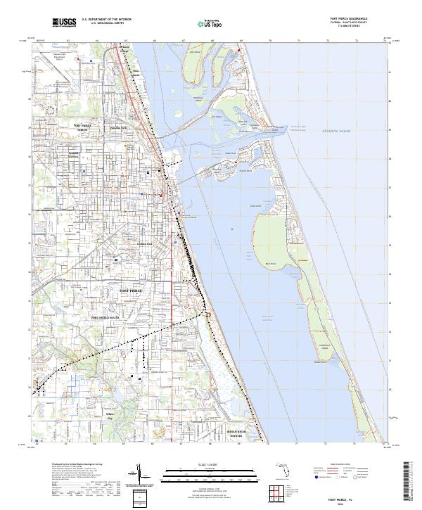
2024 Map of Fort Pierce
USGS Topo · Published 2024About this map
Fort Pierce and its surrounding coastal communities are meticulously documented in this contemporary survey of St. Lucie County. The map details the urban core near the Saint Lucie County Courthouse and radiates out to established neighborhoods like Paradise Park, Sunland Gardens, and the historic St. Lucie Village to the north. Educational and industrial anchors such as the Indian River State College and the Treasure Coast International Airport define the local economy, while the Riverview Memorial Park Pine Grove Cem provides essential data for genealogical research.
Find a feature on this map
70 named features on this map. Tap any name to fly to it.
Don’t see what you’re looking for? This feature index may not catch every label — zoom into the map to look around manually.
Map Details
Editions of this 2024 Fort Pierce Map
This is the sole edition of this map. No revisions or reprints were ever made.
Other maps of this area

1948 · Ankona
USGS Topo · 1:24,000

1948 · Eden
USGS Topo · 1:24,000

1948 · Indrio
USGS Topo · 1:24,000

1949 · Fort Pierce
USGS Topo · 1:24,000

1949 · Oslo
USGS Topo · 1:24,000

1949 · Fort Pierce NW
USGS Topo · 1:24,000

1950 · Ankona
USGS Topo · 1:24,000

1950 · Fort Pierce
USGS Topo · 1:24,000

1950 · Fort Pierce NW
USGS Topo · 1:24,000

1950 · Oslo
USGS Topo · 1:24,000