
1950 Map of Fort Randall
USGS Topo · Published 1950About this map
Thornbrough Air Force Base and the adjacent military installation at Fort Randall anchor this mid-century survey of the western Alaska Peninsula. Located at the head of Cold Bay, these facilities reflect the strategic importance of the region following World War II, complete with a designated Landing Strip and multiple radio towers. The landscape transitions from the volcanic heights of Frosty Peak and the Aghileen Pinnacles to a complex coastline of lagoons and coves. Local industry and settlement are represented by the fishing hub at King Cove, the village of Belkofski, and a Cannery (Abandoned) on the shores of Morzhovoi Bay. Further west, the map reaches across Bechevin Bay to the eastern tip of Unimak Island, illustrating the maritime routes and navigational aids like the Sealion Rocks Light that connected these remote coastal outposts.
Find a feature on this map
69 named features on this map. Tap any name to fly to it.
Don’t see what you’re looking for? This feature index may not catch every label — zoom into the map to look around manually.
Map Details
Editions of this 1950 Fort Randall Map
2 editions found
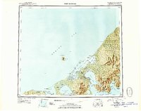
Other maps of this area

1943 · Fort Randall
USGS Topo · 1:250,000
1944 · Cold Bay Sheet No. 20 of 25
USGS Topo · 1:25,000
1944 · Cold Bay Sheet No. 1 of 25
USGS Topo · 1:25,000
1944 · Cold Bay Sheet No. 2 of 25
USGS Topo · 1:25,000

1949 · False Pass
USGS Topo · 1:250,000

1949 · Fort Randall
USGS Topo · 1:250,000

1950 · False Pass
USGS Topo · 1:250,000

1951 · Unimak
USGS Topo · 1:250,000

1953 · Port Moller
USGS Topo · 1:250,000

1958 · Unimak
USGS Topo · 1:250,000