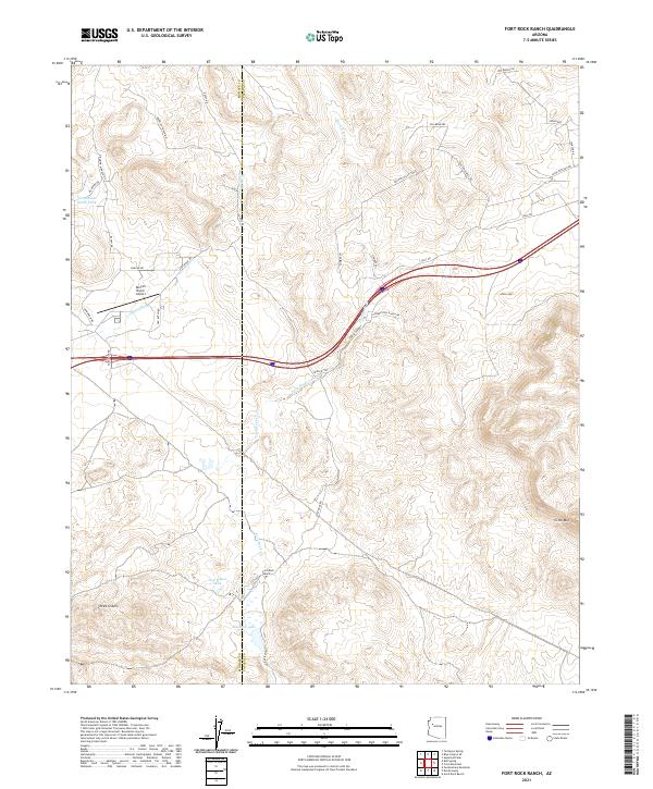
2021 Map of Fort Rock Ranch
USGS Topo · Published 2021About this map
Fort Rock Ranch and its surrounding high-desert landscape sit at the intersection of Mohave and Yavapai counties, where ranching operations are supported by a network of water features like Little Dam North Tank, Tom Bacon Lake, and Meadow Lake. The terrain is defined by prominent elevations such as Three Sisters and Cross Mtn, while the drainage of Fork Rock Creek and Trout Cr shapes the flow of the land. Aviation access to this remote interior is facilitated by the Dunton Ranch Airport, highlighting the region's continued reliance on light aircraft for connectivity. A complex grid of named ranch roads, including Double D Ranch Rd and Duffy Rd, provides the essential infrastructure for livestock management and local travel across the Elk Meadows.
Find a feature on this map
39 named features on this map. Tap any name to fly to it.
Don’t see what you’re looking for? This feature index may not catch every label — zoom into the map to look around manually.
Map Details
Editions of this 2021 Fort Rock Ranch Map
This is the sole edition of this map. No revisions or reprints were ever made.
Other maps of this area

1886 · Diamond Creek
USGS Topo · 1:250,000

1892 · Diamond Creek
USGS Topo · 1:250,000

1948 · Williams
USGS Topo · 1:250,000

1954 · Williams
USGS Topo · 1:250,000

1956 · Williams
USGS Topo · 1:250,000

1960 · Williams
USGS Topo · 1:250,000

1961 · Williams
USGS Topo · 1:250,000
1980 · Fort Rock Ranch
USGS Topo · 1:24,000
1980 · Anvil Rock Ranch
USGS Topo · 1:24,000
1980 · Cross Mountain
USGS Topo · 1:24,000