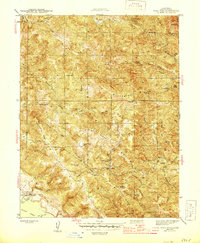
1944 Map of Fort Ross
USGS Topo · Published 1944About this map
Fort Ross and the immediate Sonoma coastline appear in 1944 as a landscape defined by ranching, resource extraction, and early heritage preservation. The Fort Ross State Historic Monument marks the site of the 19th-century Russian settlement, while the surrounding hills are punctuated by family-named holdings like Seafeldt Ranch and Happy Hill Ranch. The presence of the Layton Mine and an inactive Manganese Mine points to the area's strategic mineral importance during the war years.
Find a feature on this map
48 named features on this map. Tap any name to fly to it.
Don’t see what you’re looking for? This feature index may not catch every label — zoom into the map to look around manually.
Map Details
Editions of this 1944 Fort Ross Map
2 editions found
Other maps of this area

1921 · Skaggs
USGS Topo · 1:62,500

1921 · Plantation
USGS Topo · 1:62,500

1942 · Arched Rock
USGS Topo · 1:24,000

1943 · Tombs Creek
USGS Topo · 1:24,000

1943 · Plantation
USGS Topo · 1:24,000

1943 · Cazadero
USGS Topo · 1:24,000

1943 · Annapolis
USGS Topo · 1:24,000

1943 · Duncans Mills
USGS Topo · 1:24,000

1943 · Skaggs Springs
USGS Topo · 1:24,000

1943 · Fort Ross
USGS Topo · 1:24,000