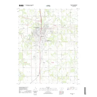
2018 Map of Fort Scott
USGS Topo · Published 2018About this map
The Fort Scott National Historic Site and the nearby Fort Scott National Cemetery dominate the urban core of Fort Scott, Kansas. This 2018 survey documents the city's modern footprint along the Marmaton River, where historically significant military and civil structures are preserved amidst a grid of residential and commercial streets. Beyond the main city limits, the map shows the smaller settlements of Edward and Godfrey situated along the primary north-south transportation corridor.
Find a feature on this map
46 named features on this map. Tap any name to fly to it.
Don’t see what you’re looking for? This feature index may not catch every label — zoom into the map to look around manually.
Map Details
Editions of this 2018 Fort Scott Map
This is the sole edition of this map. No revisions or reprints were ever made.
Other maps of this area

1884 · Fort Scott
USGS Topo · 1:125,000

1886 · Fort Scott
USGS Topo · 1:125,000

1893 · Fort Scott
USGS Topo · 1:125,000

1939 · Deerfield
USGS Topo · 1:24,000

1942 · Richards
USGS Topo · 1:24,000

1942 · Deerfield
USGS Topo · 1:24,000

1947 · Joplin
USGS Topo · 1:250,000

1948 · Mulberry
USGS Topo · 1:62,500

1948 · Girard
USGS Topo · 1:62,500
1948 · Garland
USGS Topo · 1:24,000