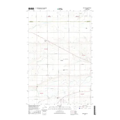
2017 Map of Fort Shaw
USGS Topo · Published 2017About this map
The Sun River corridor south of Great Falls defines the irrigation and settlement patterns of this landscape, anchored by the historic community of Fort Shaw. This area serves as a focal point for researchers interested in the agrarian development of Cascade County, where an extensive network of water works including the Greenfield S Canal, Mill Coulee Canal, and the Sun River Valley Ditch underscores the region's reliance on managed water. The map traces the land's elevation through distinct geographic markers like the Second Bench, First Bench, and the prominent Ashuelot Bench. Near the river, the Fort Shaw Cem provides a tangible link to the area's early residents. Further north, the settlement of Ashuelot sits along the highway, while the rugged Blackfoot Coulee and Rocky Reef break up the flat agricultural expanses, illustrating the varied terrain of the Montana plains.
Find a feature on this map
44 named features on this map. Tap any name to fly to it.
Don’t see what you’re looking for? This feature index may not catch every label — zoom into the map to look around manually.
Map Details
Editions of this 2017 Fort Shaw Map
This is the sole edition of this map. No revisions or reprints were ever made.
Other maps of this area

1886 · Great Falls
USGS Topo · 1:250,000

1949 · Cascade
USGS Topo · 1:62,500

1949 · Vaughn
USGS Topo · 1:62,500

1950 · Fairfield
USGS Topo · 1:62,500

1951 · Cascade
USGS Topo · 1:62,500

1952 · Vaughn
USGS Topo · 1:62,500

1954 · Great Falls
USGS Topo · 1:250,000

1957 · Great Falls
USGS Topo · 1:250,000

1960 · Simms
USGS Topo · 1:62,500

1976 · Great Falls North
USGS Topo · 1:100,000