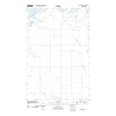
2011 Map of Fort Totten
USGS Topo · Published 2011About this map
Fort Totten and the Fort Totten Indian Agency serve as the primary hubs on this landscape south of the sweeping shoreline of Devils Lake. The terrain is defined by a dense concentration of glacial water bodies, including Sweetwater Lake, Court Lake, and Mission Bay Lake, which create a complex wetland environment. Rising above the low-lying waters is Sullys Hill, a prominent geographic feature that overlooks the surrounding prairie.
Find a feature on this map
31 named features on this map. Tap any name to fly to it.
Don’t see what you’re looking for? This feature index may not catch every label — zoom into the map to look around manually.
Map Details
Editions of this 2011 Fort Totten Map
This is the sole edition of this map. No revisions or reprints were ever made.
Other maps of this area

1928 · Tokio
USGS Topo · 1:62,500

1931 · Oberon
USGS Topo · 1:62,500

1931 · Tokio
USGS Topo · 1:62,500

1931 · Devils Lake
USGS Topo · 1:62,500

1932 · Grahams Island
USGS Topo · 1:62,500

1950 · Sheyenne
USGS Topo · 1:24,000
1950 · Tokio SW
USGS Topo · 1:24,000

1950 · Tokio
USGS Topo · 1:24,000

1950 · Grahams Island
USGS Topo · 1:62,500

1950 · Devils Lake
USGS Topo · 1:62,500
Featured Places
- Wood Lake District, ND
- St. Michael District, ND
- Fort Totten District, ND
- Fort Totten, Fort Totten District
- Benson County, ND