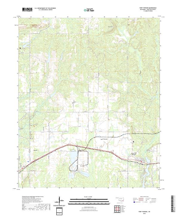
2022 Map of Fort Towson
USGS Topo · Published 2022About this map
Fort Towson and the neighboring community of West Fort Towson anchor this area of eastern Choctaw County, where the landscape is defined by the drainages of Gates Creek and Fort Towson Cr. The settlement pattern reflects deep roots in the territory, with numerous burial sites including the Old Fort Towson Cem and Box Springs Cem marking the locations of early residents. To the west, the community of Sawyer is situated near Schooler Lake, while the north is dominated by the prominence of Round Mtn. A complex network of county roads like Tucker Rd and Iron Stob Rd connects these rural hubs. The map illustrates a region where local waterways such as Rock Cr and Bird Cr have long dictated the placement of homesteads and transport routes across the Oklahoma prairie.
Find a feature on this map
70 named features on this map. Tap any name to fly to it.
Don’t see what you’re looking for? This feature index may not catch every label — zoom into the map to look around manually.
Map Details
Editions of this 2022 Fort Towson Map
This is the sole edition of this map. No revisions or reprints were ever made.
Other maps of this area

1901 · Alikchi
USGS Topo · 1:125,000

1950 · Mcalester
USGS Topo · 1:250,000

1951 · Frogville
USGS Topo · 1:24,000

1951 · Shoals
USGS Topo · 1:24,000

1951 · Kiomatia
USGS Topo · 1:24,000

1953 · Texarkana
USGS Topo · 1:250,000

1956 · Texarkana
USGS Topo · 1:250,000

1962 · McAlester
USGS Topo · 1:250,000

1962 · Sobol
USGS Topo · 1:24,000
1962 · Swink
USGS Topo · 1:24,000