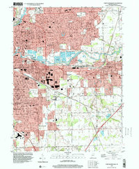
1998 Map of Fort Wayne East
USGS Topo · Published 2001About this map
The Maumee River and St Joseph River converge in this late-twentieth-century study of eastern Fort Wayne. The landscape is a dense assembly of mid-century residential expansion and established institutional hubs, notably the Fort Wayne State Development Center and Concordia Sem. Suburban developments like Hacienda Village, Sunnymede Woods, and Anthony Wayne Village characterize the growth of Allen County during this era, while the industrial legacy remains visible through the Norfolk and Western and Pennsylvania railroad corridors. Social and educational infrastructure is exceptionally well-documented, from the Veterans Hosp to numerous parochial schools such as St Charles Borromeo Sch and St Henrys Sch. The transition into New Haven shows a mix of residential plats and utility works like the Sewage Filter Beds along the riverbanks.
Find a feature on this map
60 named features on this map. Tap any name to fly to it.
Don’t see what you’re looking for? This feature index may not catch every label — zoom into the map to look around manually.
Map Details
Editions of this 1998 Fort Wayne East Map
This is the sole edition of this map. No revisions or reprints were ever made.
Other maps of this area

1953 · Fort Wayne
USGS Topo · 1:250,000

1953 · Muncie
USGS Topo · 1:250,000

1956 · Muncie
USGS Topo · 1:250,000

1956 · Fort Wayne
USGS Topo · 1:250,000

1956 · Fort Wayne West
USGS Topo · 1:24,000

1956 · Fort Wayne East
USGS Topo · 1:24,000

1956 · Cedarville
USGS Topo · 1:24,000

1957 · Maples
USGS Topo · 1:24,000

1957 · Huntertown
USGS Topo · 1:24,000

1958 · Grabill
USGS Topo · 1:24,000