
1955 Map of Fort Yukon D-5
USGS Topo · Published 1966About this map
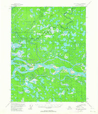
The Chandalar River dominates this interior landscape, winding through a complex system of braided channels and sandbars as it flows toward the Yukon. Mapped in the mid-1950s using photogrammetric methods from aerial photographs, the area is characterized by an intricate network of wetlands and small water bodies, including the Vunikh Lakes and Chahovun Lakes in the northeast. Much of the eastern portion of the map is defined by the Venetie Indian Reservation, its presence marked by the Venetie Indian Reservation Boundary cutting through the river system.
Find a feature on this map
10 named features on this map. Tap any name to fly to it.
Don’t see what you’re looking for? This feature index may not catch every label — zoom into the map to look around manually.
Map Details
Editions of this 1955 Fort Yukon D-5 Map
This is the sole edition of this map. No revisions or reprints were ever made.
Other maps of this area

1951 · Fort Yukon
USGS Topo · 1:250,000

1951 · Christian
USGS Topo · 1:250,000

1952 · Fort Yukon C-4
USGS Topo · 1:63,360

1955 · Fort Yukon D-4
USGS Topo · 1:63,360

1955 · Fort Yukon C-5
USGS Topo · 1:63,360

1956 · Fort Yukon C-5
USGS Topo · 1:63,360

1956 · Christian
USGS Topo · 1:250,000

1956 · Fort Yukon
USGS Topo · 1:250,000
1956 · Fort Yukon C-4
USGS Topo · 1:63,360
1956 · Fort Yukon D-6
USGS Topo · 1:63,360