
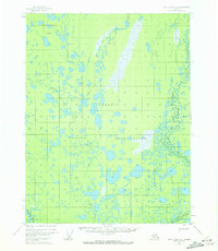
1955 Map of Fort Yukon D-4
USGS Topo · Published 1958About this map
Venetie Indian Reservation dominates this mid-century topographic study, revealing an intricate aquatic landscape of the Yukon-Koyukuk region. The interior is defined by a dense network of hydrologic features, including the sprawling Vehtenjerlow Lakes and the winding courses of the Christian River and Chandalar River. While the terrain is predominantly water and marshland, human presence is recorded at the settlement of Tsukon and scattered Cabins located near the riverbanks. A notable logistical element is the Sled Trail (Approximate) which cuts through the eastern portion of the quadrangle near Twentymile Lake, indicating the seasonal transport methods essential to this subarctic environment. The lack of permanent roads highlights the reliance on waterways like Kocacho Creek and Marten Creek for movement through the interior during this era.
Find a feature on this map
10 named features on this map. Tap any name to fly to it.
Don’t see what you’re looking for? This feature index may not catch every label — zoom into the map to look around manually.
Map Details
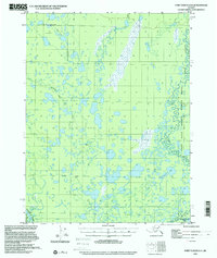
Editions of this 1955 Fort Yukon D-4 Map
3 editions found
Other maps of this area

1951 · Fort Yukon
USGS Topo · 1:250,000

1951 · Christian
USGS Topo · 1:250,000

1952 · Fort Yukon C-3
USGS Topo · 1:63,360

1952 · Fort Yukon C-4
USGS Topo · 1:63,360

1955 · Fort Yukon D-3
USGS Topo · 1:63,360

1955 · Fort Yukon C-3
USGS Topo · 1:63,360

1955 · Fort Yukon D-5
USGS Topo · 1:63,360

1955 · Fort Yukon C-5
USGS Topo · 1:63,360

1956 · Fort Yukon C-5
USGS Topo · 1:63,360

1956 · Christian
USGS Topo · 1:250,000