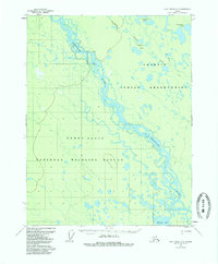
1956 Map of Fort Yukon D-5
USGS Topo · Published 1985About this map
The Chandalar River meanders through a vast network of wetlands and seasonal water bodies in this mid-century survey of the Alaskan interior. This landscape is defined by the braided channels of the river as it flows through the Yukon Flats, an area where the transition between water and land is constantly shifting. The map delineates the boundaries of the Venetie Indian Reservation and the National Wildlife Refuge, highlighting the protected status of these remote territories.
Find a feature on this map
10 named features on this map. Tap any name to fly to it.
Don’t see what you’re looking for? This feature index may not catch every label — zoom into the map to look around manually.
Map Details
Editions of this 1956 Fort Yukon D-5 Map
This is the sole edition of this map. No revisions or reprints were ever made.
Other maps of this area

1951 · Fort Yukon
USGS Topo · 1:250,000

1951 · Christian
USGS Topo · 1:250,000

1952 · Fort Yukon C-4
USGS Topo · 1:63,360

1955 · Fort Yukon D-4
USGS Topo · 1:63,360

1955 · Fort Yukon D-5
USGS Topo · 1:63,360

1955 · Fort Yukon C-5
USGS Topo · 1:63,360

1956 · Fort Yukon C-5
USGS Topo · 1:63,360

1956 · Christian
USGS Topo · 1:250,000

1956 · Fort Yukon
USGS Topo · 1:250,000
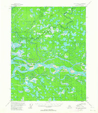
1956 · Fort Yukon C-4
USGS Topo · 1:63,360