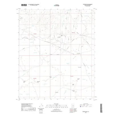
2018 Map of Fortified Peak
USGS Topo · Published 2018About this map
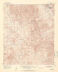
Fortified Peak stands as the central landmark in this Pinal County landscape, which is defined by an intricate network of desert drainages and livestock water infrastructure. In the late 2010s, the area shows a distinct pattern of land use where rugged terrain features like Suffering Gulch and Falcon Divide are navigated via modern paths such as His/Hers Trail and Bones Trail. The settlement at Falcon Valley lies to the southeast, while the surrounding desert is punctuated by essential water catchments, including Tipperary Tank, Coronado Tank, and Wild Cow Tank. This map also captures the path of energy infrastructure through the desert, marked by the Gasline and its Gasline Bypass. Regional water flow is illustrated by significant drainages such as Bloodsucker Wash and Chirreones Arroyo, reflecting the arid geography of the Santa Cruz Valley periphery.
Find a feature on this map
57 named features on this map. Tap any name to fly to it.
Don’t see what you’re looking for? This feature index may not catch every label — zoom into the map to look around manually.
Map Details
Editions of this 2018 Fortified Peak Map
This is the sole edition of this map. No revisions or reprints were ever made.
Other maps of this area

1911 · Winkelman
USGS Topo · 1:125,000

1913 · Winkelman
USGS Topo · 1:125,000

1934 · Newman Peak
USGS Topo · 1:125,000

1949 · Winkelman
USGS Topo · 1:62,500

1949 · Black Mountain
USGS Topo · 1:24,000
1949 · Putnam Wash
USGS Topo · 1:24,000
1950 · Putnam Wash
USGS Topo · 1:24,000
1950 · Black Mountain
USGS Topo · 1:24,000
1951 · Winkelman
USGS Topo · 1:62,500

1956 · Tucson
USGS Topo · 1:250,000