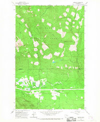
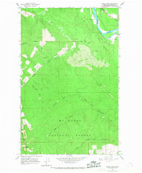
1966 Map of Fortson
USGS Topo · Published 1968About this map
The Northern Pacific railroad corridor follows the valley floor in this 1960s study of the Cascades foothills, where the North Fork Stillaguamish River defines the local geography. Small settlements like Fortson and Swede Heaven are situated along the river's path, supported by the local timber and rail economy. The map captures the industrial and natural intersection of the region, noting a Fish Hatchery, several Gravel Pits, and a Darrington Substation alongside the recreational footprint of Squire Creek Park.
Find a feature on this map
33 named features on this map. Tap any name to fly to it.
Don’t see what you’re looking for? This feature index may not catch every label — zoom into the map to look around manually.
Map Details
Editions of this 1966 Fortson Map
3 editions found
Other maps of this area

1899 · Stillaguamish
USGS Topo · 1:125,000

1901 · Stilaguamish
USGS Topo · 1:125,000

1955 · Concrete
USGS Topo · 1:250,000

1956 · Oso
USGS Topo · 1:62,500

1956 · Granite Falls
USGS Topo · 1:62,500

1957 · Silverton
USGS Topo · 1:62,500

1958 · Concrete
USGS Topo · 1:250,000

1962 · Concrete
USGS Topo · 1:250,000
1966 · Darrington
USGS Topo · 1:24,000
1966 · Finney Peak
USGS Topo · 1:24,000