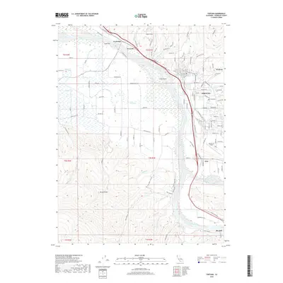
2018 Map of Fortuna
USGS Topo · Published 2018About this map
The Eel River and its confluence with the Van Duzen River define this coastal river valley landscape in Humboldt County. This 2018 survey documents the regional center of Fortuna, alongside the riverside settlements of Fernbridge, Alton, and Rio Dell. The map captures the significant agricultural and residential development concentrated on the terrace known as Sandy Prairie, while the southern and western portions of the quadrangle rise into steeper terrain towards Buzzards Peak. Researchers will find local infrastructure well-documented, from the Rohnerville Airport to the historic footprints of Worswick and Newburg. The network of local roads, such as Grizzly Bluff Rd and Singley Bar Rd, illustrates the complex relationship between the flood-prone river flats and the surrounding uplands.
Find a feature on this map
120 named features on this map. Tap any name to fly to it.
Don’t see what you’re looking for? This feature index may not catch every label — zoom into the map to look around manually.
Map Details
Editions of this 2018 Fortuna Map
This is the sole edition of this map. No revisions or reprints were ever made.
Other maps of this area

1916 · Cape Fortunas
USGS Topo · 1:62,500

1919 · Glynn
USGS Topo · 1:62,500

1921 · Cape Mendocino
USGS Topo · 1:62,500

1943 · Ferndale
USGS Topo · 1:62,500

1944 · Fortuna
USGS Topo · 1:62,500

1949 · Eureka
USGS Topo · 1:250,000

1950 · Cape Mendocino
USGS Topo · 1:62,500

1950 · Scotia
USGS Topo · 1:62,500

1951 · Scotia
USGS Topo · 1:62,500

1951 · Cape Mendocino
USGS Topo · 1:62,500