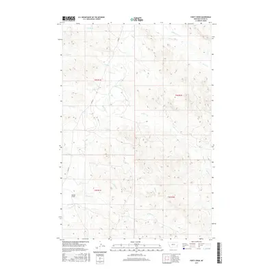
2017 Map of Forty Creek
USGS Topo · Published 2017About this map
Dawson Coulee sits at the heart of this Custer County landscape, where an intricate network of seasonal drainage and creek beds defines the local topography. This 2017 survey by the U.S. Geological Survey illustrates a sparsely populated section of Montana, where the land is largely organized around the branching waters of Forty Creek and Mizpah Cr. The presence of Windmill Cr and Double Corral Cr points to a rural economy rooted in ranching and livestock, requiring reliable water access in a region of high plains. Transport is limited to a primary artery, Mizpah Rd, which cuts north-south across the western terrain, connecting the drainages of Timothy Cr and Doat Cr. The map preserves the township and range divisions, such as t4n r51e, providing a clear structural framework for land ownership and genealogical research in this portion of the Montana range.
Find a feature on this map
21 named features on this map. Tap any name to fly to it.
Don’t see what you’re looking for? This feature index may not catch every label — zoom into the map to look around manually.
Map Details
Editions of this 2017 Forty Creek Map
This is the sole edition of this map. No revisions or reprints were ever made.
Other maps of this area

1953 · Miles City
USGS Topo · 1:250,000

1954 · Ekalaka
USGS Topo · 1:250,000

1956 · Ekalaka
USGS Topo · 1:250,000

1957 · Miles City
USGS Topo · 1:250,000

1958 · Miles City
USGS Topo · 1:250,000

1958 · Ekalaka
USGS Topo · 1:250,000

1965 · Ekalaka
USGS Topo · 1:250,000

1969 · Mizpah
USGS Topo · 1:24,000

1969 · Loaf of Bread Butte
USGS Topo · 1:24,000

1969 · Forty Creek
USGS Topo · 1:24,000