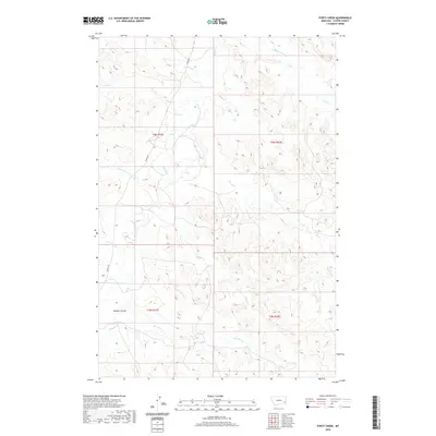
2020 Map of Forty Creek
USGS Topo · Published 2020About this map
Mizpah Cr winds through this section of Custer County, defining a drainage network that sustains the ranching landscape of eastern Montana. This 2020 survey illustrates the complex hydrology of the region, where numerous named tributaries such as Timothy Cr, Doat Cr, and Pinto Cr feed into the larger creek systems. The terrain is characterized by the branching coulees and draws of the high plains, most notably Dawson Coulee in the southwest. Land management and historical surveying are evident through the established township lines of t4n r51e and t4n r52e, reflecting the orderly grid imposed on the undulating prairie. Water remains the central feature of this environment, with labels like Windmill Cr and Double Corral Cr suggesting the practical human relationship with this semi-arid geography.
Find a feature on this map
19 named features on this map. Tap any name to fly to it.
Don’t see what you’re looking for? This feature index may not catch every label — zoom into the map to look around manually.
Map Details
Editions of this 2020 Forty Creek Map
This is the sole edition of this map. No revisions or reprints were ever made.
Other maps of this area

1953 · Miles City
USGS Topo · 1:250,000

1954 · Ekalaka
USGS Topo · 1:250,000

1956 · Ekalaka
USGS Topo · 1:250,000

1957 · Miles City
USGS Topo · 1:250,000

1958 · Miles City
USGS Topo · 1:250,000

1958 · Ekalaka
USGS Topo · 1:250,000

1965 · Ekalaka
USGS Topo · 1:250,000

1969 · Mizpah
USGS Topo · 1:24,000

1969 · Loaf of Bread Butte
USGS Topo · 1:24,000

1969 · Forty Creek
USGS Topo · 1:24,000