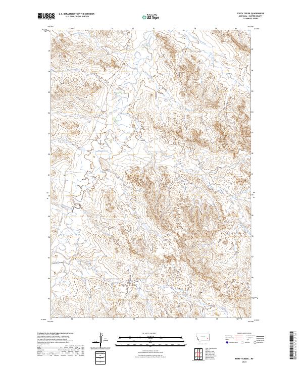
2024 Map of Forty Creek
USGS Topo · Published 2024About this map
Mizpah Rd cuts a lone path through this drainage basin in Custer County, following the winding course of Mizpah Creek as it moves through the Montana landscape. This contemporary survey details a complex network of ephemeral waterways and coulees, where named features like Dawson Coulee and Windmill Creek define the local topography. The map illustrates a landscape primarily organized by ranching and grazing boundaries, centered around the confluence of many small tributaries. Highlighting the hydrologic patterns of the region, the survey traces the distinct branches of Forty Creek, including West Forty Creek and East Forty Creek, alongside other descriptively named waters like Double Corral Creek and Bridge Creek. The arrangement of these labels reveals the essential reliance on water sources in this part of the state, serving as a primary reference for those studying land use and historical water rights in the area.
Find a feature on this map
20 named features on this map. Tap any name to fly to it.
Don’t see what you’re looking for? This feature index may not catch every label — zoom into the map to look around manually.
Map Details
Editions of this 2024 Forty Creek Map
This is the sole edition of this map. No revisions or reprints were ever made.
Other maps of this area

1953 · Miles City
USGS Topo · 1:250,000

1954 · Ekalaka
USGS Topo · 1:250,000

1956 · Ekalaka
USGS Topo · 1:250,000

1957 · Miles City
USGS Topo · 1:250,000

1958 · Miles City
USGS Topo · 1:250,000

1958 · Ekalaka
USGS Topo · 1:250,000

1965 · Ekalaka
USGS Topo · 1:250,000

1969 · Mizpah
USGS Topo · 1:24,000

1969 · Loaf of Bread Butte
USGS Topo · 1:24,000

1969 · Forty Creek
USGS Topo · 1:24,000