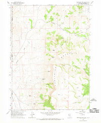
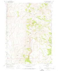
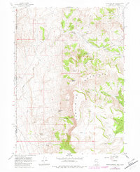
1966 Map of Fortynine Mtn.
USGS Topo · Published 1969About this map
Fortynine Creek and the high ridges of Fortynine Mountain dominate this mid-1960s survey of the Nevada-California borderlands. The landscape is defined by its critical water sources, evidenced by a high density of named springs such as Quaking Asp Spring, Sagebrush Spring, and Koenig Spring. These points of reliable water supported the transit and seasonal habitation of the high desert, centered around Fortynine Camp in the northern portion of the quadrangle.
Find a feature on this map
27 named features on this map. Tap any name to fly to it.
Don’t see what you’re looking for? This feature index may not catch every label — zoom into the map to look around manually.
Map Details
Editions of this 1966 Fortynine Mtn. Map
3 editions found
Other maps of this area

1886 · Alturas
USGS Topo · 1:250,000

1889 · Long Valley
USGS Topo · 1:250,000

1892 · Alturas
USGS Topo · 1:250,000

1954 · Vya
USGS Topo · 1:250,000

1954 · Alturas
USGS Topo · 1:250,000

1958 · Alturas
USGS Topo · 1:250,000

1958 · Vya
USGS Topo · 1:250,000

1962 · Alturas
USGS Topo · 1:250,000

1962 · Vya
USGS Topo · 1:250,000
1962 · Cedarville
USGS Topo · 1:62,500