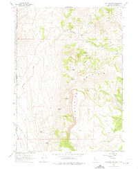
1966 Map of Fortynine Mtn.
USGS Topo · Published 1974About this map
Fortynine Mountain dominates this mid-1960s landscape, positioned along the high-desert border between Nevada and California. The map records a series of vital water sources essential for survival in this arid terrain, including Quaking Asp Spring, Saddle Spring, and Sagebrush Spring. Human presence is marked by small outposts such as Fortynine Camp and the settlement at Helen, while family names are preserved at Farmer Spring and Koenig Spring. To the west, the map transitions into the Surprise Valley, while the eastern side features the Long Valley (Depression). The network of jeep trails and the Dugway Road reflect the remote character of this region, which was mapped by the U.S. Geological Survey using photogrammetric methods from 1965 aerial photography and field-checked in 1966.
Find a feature on this map
29 named features on this map. Tap any name to fly to it.
Don’t see what you’re looking for? This feature index may not catch every label — zoom into the map to look around manually.
Map Details
Editions of this 1966 Fortynine Mtn. Map
3 editions found
Other maps of this area

1886 · Alturas
USGS Topo · 1:250,000

1889 · Long Valley
USGS Topo · 1:250,000

1892 · Alturas
USGS Topo · 1:250,000

1954 · Vya
USGS Topo · 1:250,000

1954 · Alturas
USGS Topo · 1:250,000

1958 · Alturas
USGS Topo · 1:250,000

1958 · Vya
USGS Topo · 1:250,000

1962 · Alturas
USGS Topo · 1:250,000

1962 · Vya
USGS Topo · 1:250,000

1962 · Cedarville
USGS Topo · 1:62,500