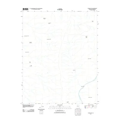
2011 Map of Fossil Bay
USGS Topo · Published 2011About this map
The Colorado River carves through the southeastern corner of this Coconino County landscape, where the turbulent Fossil Rapids define the river's path through the deep incision of Fossil Canyon. This 2011 survey documents a geography of stark verticality, characterized by massive high-elevation features like Great Thumb Mesa and a series of named promontories including Bear Headland, Kangaroo Headland, and Panameta Point. The land is tiered by significant geological benches such as Gatagama Terrace in the north and Alarcon Terrace in the south, suggesting the ancient erosional history of the canyon systems. Aside from the primary watercourse, the interior is dominated by a complex network of ephemeral drainages that feed into Fossil Bay, a large topographic depression. Notable landmarks like Enfilade Point and Stanton Point provide specific reference points for navigating this unpopulated and primitive terrain in the northern Arizona wilderness.
Find a feature on this map
17 named features on this map. Tap any name to fly to it.
Don’t see what you’re looking for? This feature index may not catch every label — zoom into the map to look around manually.
Map Details
Editions of this 2011 Fossil Bay Map
This is the sole edition of this map. No revisions or reprints were ever made.
Other maps of this area

1886 · Kaibab
USGS Topo · 1:250,000

1953 · Grand Canyon
USGS Topo · 1:250,000

1957 · Grand Canyon
USGS Topo · 1:250,000

1958 · Grand Canyon
USGS Topo · 1:250,000

1960 · Grand Canyon
USGS Topo · 1:250,000

1962 · Kanab Point
USGS Topo · 1:62,500

1962 · Havasupai Point
USGS Topo · 1:62,500
1962 · Powell Plateau
USGS Topo · 1:62,500

1962 · Supai
USGS Topo · 1:62,500

1984 · Grand Canyon
USGS Topo · 1:100,000