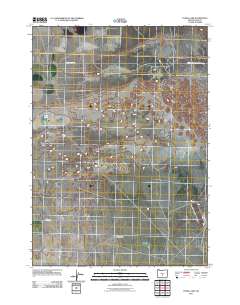
2011 Map of Fossil Lake
USGS Topo · Published 2011About this map
Fossil Lake occupies a central role in this high desert landscape, appearing as a focal point in an area defined by sparse water and expansive basins. The map illustrates the structured development of Christmas Lake Valley, where a distinct grid of agricultural plots and residential roads meets the natural contours of the basin floor. The human footprint is further traced through remote access routes like Bureau of Land Mgmt Road 6151 and County Hwy 5-14E, which connect this isolated interior to the broader region. This 2011 survey highlights the intersection of modern land management and the ancient geological features of the Oregon desert, revealing how local roads like Sams Way navigate the flat, open terrain.
Find a feature on this map
5 named features on this map. Tap any name to fly to it.
Don’t see what you’re looking for? This feature index may not catch every label — zoom into the map to look around manually.
Map Details
Editions of this 2011 Fossil Lake Map
This is the sole edition of this map. No revisions or reprints were ever made.
Other maps of this area

1955 · Crescent
USGS Topo · 1:250,000

1957 · Crescent
USGS Topo · 1:250,000

1958 · Crescent
USGS Topo · 1:250,000

1970 · Crescent
USGS Topo · 1:250,000

1981 · Fossil Lake
USGS Topo · 1:24,000

1981 · Sand Rock
USGS Topo · 1:24,000

1981 · Moonlight Butte
USGS Topo · 1:24,000

1981 · Mean Rock Well
USGS Topo · 1:24,000

1982 · Peters Creek Sink
USGS Topo · 1:24,000

1982 · Christmas Lake
USGS Topo · 1:24,000