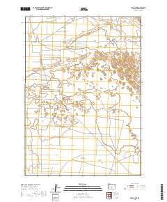
2020 Map of Fossil Lake
USGS Topo · Published 2020About this map
Fossil Lake sits at the northern edge of this high-desert landscape in Lake County, where the topography of the Christmas Lake Valley is defined by ancient lakebeds and subtle elevation changes. This 2020 survey illustrates a region where land management and rural access take precedence, as seen in the grid of local connectors like Five Acre Rd and Ruppel Rd. The presence of BLM Rd 6151 and Lost Forest Ln indicates the importance of federal land oversight in this arid basin. Researchers will note the distinct transition from the open valley floor to the more complex terrain in the northeast, where scattered wetlands and ephemeral water features have historically shaped the settlement patterns of this corner of the Great Basin.
Find a feature on this map
15 named features on this map. Tap any name to fly to it.
Don’t see what you’re looking for? This feature index may not catch every label — zoom into the map to look around manually.
Map Details
Editions of this 2020 Fossil Lake Map
This is the sole edition of this map. No revisions or reprints were ever made.
Other maps of this area

1955 · Crescent
USGS Topo · 1:250,000

1957 · Crescent
USGS Topo · 1:250,000

1958 · Crescent
USGS Topo · 1:250,000

1970 · Crescent
USGS Topo · 1:250,000

1981 · Fossil Lake
USGS Topo · 1:24,000

1981 · Sand Rock
USGS Topo · 1:24,000

1981 · Moonlight Butte
USGS Topo · 1:24,000

1981 · Mean Rock Well
USGS Topo · 1:24,000

1982 · Peters Creek Sink
USGS Topo · 1:24,000

1982 · Christmas Lake
USGS Topo · 1:24,000