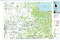
1985 Map of Fosston
USGS Topo · Published 1985About this map
Red Lake Indian Reservation dominates the northeastern portion of this mid-1980s landscape, bordering the expansive Lower Red Lake. The map illustrates a region defined by its complex drainage systems and conservation areas, where the Clearwater River and Lost River wind through numerous state-managed lands such as the Gully State Wildlife Management Area and the Polk-Clearwater State Game Refuge.
Find a feature on this map
42 named features on this map. Tap any name to fly to it.
Don’t see what you’re looking for? This feature index may not catch every label — zoom into the map to look around manually.
Map Details
Editions of this 1985 Fosston Map
2 editions found
Other maps of this area

1918 · Terrebonne
USGS Topo · 1:62,500

1918 · Jelle
USGS Topo · 1:62,500

1919 · Fosston
USGS Topo · 1:62,500

1919 · Grit
USGS Topo · 1:62,500

1919 · Solway
USGS Topo · 1:62,500

1919 · Churnes
USGS Topo · 1:62,500

1919 · Ponemah
USGS Topo · 1:62,500

1919 · Winsor
USGS Topo · 1:62,500

1919 · Valley
USGS Topo · 1:62,500

1920 · Buena Vista
USGS Topo · 1:62,500