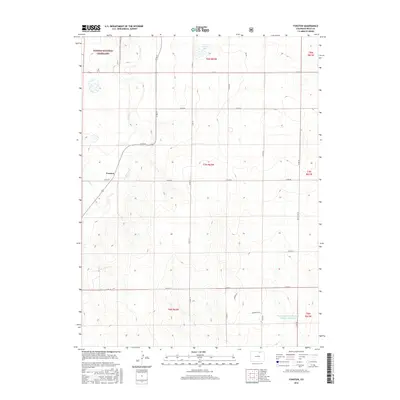
2016 Map of Fosston
USGS Topo · Published 2016About this map
Pawnee National Grassland dominates the northwestern portion of this 2016 survey, where the high plains of Weld County meet the drainage of Crow Cr. The settlement of Fosston serves as a local waypoint along Co RD 80, situated near where Sand Cr joins the larger creek system. This landscape is defined by its regular section lines and a grid of county roads, including Co RD 77 and Co RD 82, which facilitate movement through the agricultural and grazing lands of northern Colorado.
Find a feature on this map
26 named features on this map. Tap any name to fly to it.
Don’t see what you’re looking for? This feature index may not catch every label — zoom into the map to look around manually.
Map Details
Editions of this 2016 Fosston Map
This is the sole edition of this map. No revisions or reprints were ever made.
Other maps of this area

1950 · Greasewood Lake
USGS Topo · 1:24,000

1950 · Barnesville
USGS Topo · 1:24,000

1951 · Point Of Rocks
USGS Topo · 1:24,000

1954 · Greeley
USGS Topo · 1:250,000

1957 · Greeley
USGS Topo · 1:250,000

1958 · Greeley
USGS Topo · 1:250,000

1961 · Greeley
USGS Topo · 1:250,000

1964 · Greeley
USGS Topo · 1:250,000

1965 · Greeley
USGS Topo · 1:250,000

1972 · Dutch Girl Lake
USGS Topo · 1:24,000