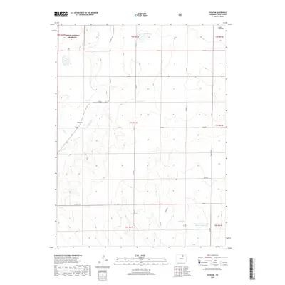
2019 Map of Fosston
USGS Topo · Published 2019About this map
Fosston sits at the center of this Weld County landscape, where the high plains meet managed water resources and protected federal lands. The northwestern corner of the quadrangle is occupied by the Pawnee National Grassland, a distinctive area of conservation that preserves the shortgrass prairie. The local drainage is defined by the winding course of Crow Cr and Sand Cr, which cut through the terrain toward the south. The human footprint in this semi-arid region is marked by a grid of county roads and specific infrastructure like the Klingenberg Flood Control Number 1 Reservoir and Bidwell Lake. A single notable elevation, Seven Cross Hill, rises in the northeast, providing a rare natural landmark in an area largely dedicated to ranching and open range. The presence of named local routes like Susieville Ln suggests small pockets of habitation and rural development amidst the vast agricultural sections.
Find a feature on this map
28 named features on this map. Tap any name to fly to it.
Don’t see what you’re looking for? This feature index may not catch every label — zoom into the map to look around manually.
Map Details
Editions of this 2019 Fosston Map
This is the sole edition of this map. No revisions or reprints were ever made.
Other maps of this area

1950 · Greasewood Lake
USGS Topo · 1:24,000

1950 · Barnesville
USGS Topo · 1:24,000

1951 · Point Of Rocks
USGS Topo · 1:24,000

1954 · Greeley
USGS Topo · 1:250,000

1957 · Greeley
USGS Topo · 1:250,000

1958 · Greeley
USGS Topo · 1:250,000

1961 · Greeley
USGS Topo · 1:250,000

1964 · Greeley
USGS Topo · 1:250,000

1965 · Greeley
USGS Topo · 1:250,000

1972 · Dutch Girl Lake
USGS Topo · 1:24,000