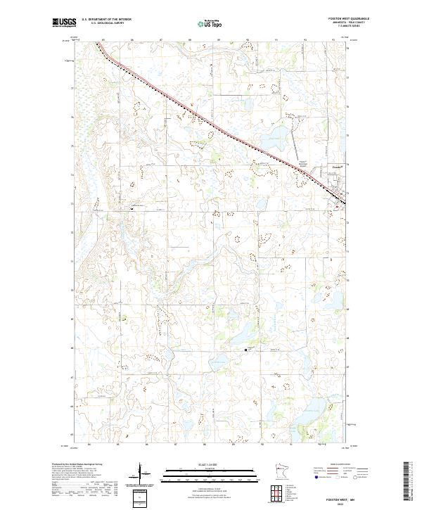
2022 Map of Fosston West
USGS Topo · Published 2022About this map
The Sand Hill River meanders across this landscape in western Polk County, defining a region where water and agriculture are closely linked. The city of Fosston sits at the eastern edge of the map, serving as a hub for the surrounding township lands of t148n r41w and t148n r40w. This area is characterized by a high concentration of small lakes and wetlands, including Strand Lake, Ouff Lake, and Kroening Lake, which are interspersed among a grid of section roads like 400th St SE. For local historians and genealogists, the map identifies specific burial sites such as Landsverk Cem and Hansville Cem, which offer physical connections to the early farming families of the prairie. The presence of the Fosston Municipal Airport and the local Industrial Ave indicates the modern economic infrastructure that supports this rural Minnesota community.
Find a feature on this map
42 named features on this map. Tap any name to fly to it.
Don’t see what you’re looking for? This feature index may not catch every label — zoom into the map to look around manually.
Map Details
Editions of this 2022 Fosston West Map
This is the sole edition of this map. No revisions or reprints were ever made.
Other maps of this area

1919 · Fosston
USGS Topo · 1:62,500

1954 · Bemidji
USGS Topo · 1:250,000

1957 · Bemidji
USGS Topo · 1:250,000

1958 · Bemidji
USGS Topo · 1:250,000

1969 · Olga
USGS Topo · 1:24,000

1969 · Mc Intosh NE
USGS Topo · 1:24,000

1969 · Fosston East
USGS Topo · 1:24,000
1969 · Mc Intosh
USGS Topo · 1:24,000

1969 · Fosston West
USGS Topo · 1:24,000
1969 · Winger
USGS Topo · 1:24,000