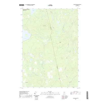
2021 Map of Foster Ridge
USGS Topo · Published 2021About this map
The Appalachian National Scenic Trail winds through the northern portion of this Maine landscape, passing just south of Bald Mountain Pond. This interior region, spanning the border between Somerset and Piscataquis counties, is defined by a dense network of water bodies and bogs, including Kingsley Bog, Nye Bog, and Whitman Bog. The presence of Hilton Cem and Titcomb Cem along the southern road networks points to the legacy of local families who settled near Crockett Ridge. Historical transport routes such as Stagecoach Rd and Blanchard Rd connect the higher elevations of Foster Ridge with the lowland drainage of Palmer Stream and the expansive Baker Flowage. The map details a wilderness area where the timber and recreation economies meet, evidenced by the numerous ponds like Austin Pond and Marble Pond.
Find a feature on this map
29 named features on this map. Tap any name to fly to it.
Don’t see what you’re looking for? This feature index may not catch every label — zoom into the map to look around manually.
Map Details
Editions of this 2021 Foster Ridge Map
This is the sole edition of this map. No revisions or reprints were ever made.
Other maps of this area

1903 · Bingham
USGS Topo · 1:62,500

1905 · Bingham
USGS Topo · 1:62,500

1905 · The Forks
USGS Topo · 1:62,500

1907 · The Forks
USGS Topo · 1:62,500

1948 · Kingsbury
USGS Topo · 1:62,500

1950 · Kingsbury
USGS Topo · 1:62,500

1951 · Greenville
USGS Topo · 1:62,500

1954 · Millinocket
USGS Topo · 1:250,000

1956 · The Forks
USGS Topo · 1:62,500

1956 · Bingham
USGS Topo · 1:62,500
Featured Places
- Blanchard Township, ME
- Kingsbury Plantation, ME
- Mayfield Township, ME
- Bald Mountain Township, ME
- Somerset County, ME