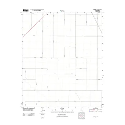
2012 Map of Foster
USGS Topo · Published 2012About this map
The High Plains landscape of Terry County is defined by a rigorous grid of section-line roads, such as Co RD-480 and Co RD-600, which carve the agricultural expanse into uniform blocks. Foster stands as a focal point in this rural network, centered around the intersection of FM-403 and Co RD-620. This area is characterized by scattered playa lakes and a sparse distribution of named points, emphasizing the open, agrarian nature of the Llano Estacado. Genealogists and local historians will find value in the Foster Cem located just west of the main settlement. Further north, the small community of Lahey marks a significant waypoint at the junction of several county roads, illustrating the historical reliance on these precise transportation corridors to connect isolated West Texas farmsteads and ranching operations.
Find a feature on this map
28 named features on this map. Tap any name to fly to it.
Don’t see what you’re looking for? This feature index may not catch every label — zoom into the map to look around manually.
Map Details
Editions of this 2012 Foster Map
This is the sole edition of this map. No revisions or reprints were ever made.
Other maps of this area

1954 · Hobbs
USGS Topo · 1:250,000

1954 · Brownfield
USGS Topo · 1:250,000

1958 · Brownfield
USGS Topo · 1:250,000

1958 · Hobbs
USGS Topo · 1:250,000

1962 · Brownfield
USGS Topo · 1:250,000

1969 · Brownfield East
USGS Topo · 1:24,000

1969 · Gomez
USGS Topo · 1:24,000

1969 · Foster
USGS Topo · 1:24,000

1969 · Loop
USGS Topo · 1:24,000

1969 · Ashmore
USGS Topo · 1:24,000