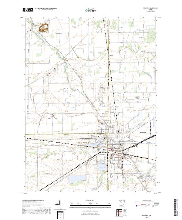
2023 Map of Fostoria
USGS Topo · Published 2023About this map
The city of Fostoria anchors this modern survey where three counties—Wood, Hancock, and Seneca—converge in Northwest Ohio. The landscape is defined by the headwaters and tributaries of several drainage systems, including the East Branch Portage River, South Branch Muddy Creek, and Wolf Creek. The area surrounding the city center is marked by significant local landmarks such as the Fostoria Metropolitan Airport and a cluster of recreational and water management features including Lamberjack Lake, Mottram Lake, and Daugherty Lake.
Find a feature on this map
131 named features on this map. Tap any name to fly to it.
Don’t see what you’re looking for? This feature index may not catch every label — zoom into the map to look around manually.
Map Details
Editions of this 2023 Fostoria Map
This is the sole edition of this map. No revisions or reprints were ever made.
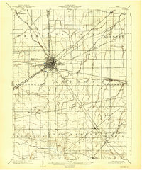
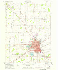
Historical Maps of Flechtner Heights Through Time
4 maps found