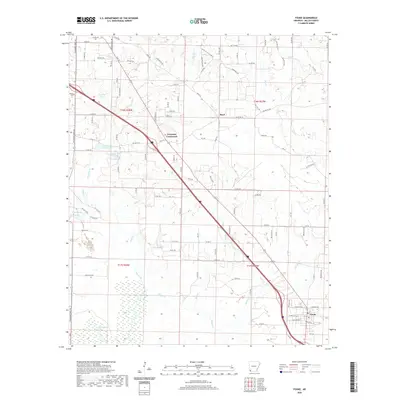
2020 Map of Fouke
USGS Topo · Published 2020About this map
The city of Fouke anchors the southeastern corner of this Miller County landscape, situated where the road network converges amidst a complex system of bottomlands and creeks. This 2020 USGS survey illustrates a rural Arkansas environment defined by its waterways, including the winding course of Days Creek and the marshy expanses around Snake Lake. The settlement pattern is largely dispersed, with small communities like Boyd and Ferguson Crossroads serving as local landmarks along the transit corridors. These routes, such as Blackman Ferry Rd and Beasley Hill Rd, follow the higher ground between drainage basins. Local history is grounded in sites like the Gibson Cem and numerous named water bodies, from Paradise Lake to the meandering Chicken Cr, which suggest a legacy of land use tied closely to the region's diverse hydrography.
Find a feature on this map
112 named features on this map. Tap any name to fly to it.
Don’t see what you’re looking for? This feature index may not catch every label — zoom into the map to look around manually.
Map Details
Editions of this 2020 Fouke Map
This is the sole edition of this map. No revisions or reprints were ever made.
Other maps of this area

1907 · Atlanta
USGS Topo · 1:62,500

1909 · Texarkana
USGS Topo · 1:62,500

1910 · Atlanta
USGS Topo · 1:62,500

1952 · Mandeville
USGS Topo · 1:24,000

1952 · Doddridge NW
USGS Topo · 1:24,000

1952 · Fouke SE
USGS Topo · 1:24,000

1952 · Doddridge NE
USGS Topo · 1:24,000

1952 · Fouke
USGS Topo · 1:24,000

1952 · Fouke NE
USGS Topo · 1:24,000

1953 · Texarkana
USGS Topo · 1:250,000