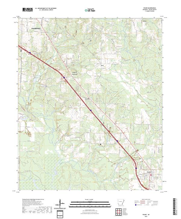
2024 Map of Fouke
USGS Topo · Published 2024About this map
Fouke anchors the southern portion of this Miller County landscape, situated at a junction where interstate travel meets the rural network of the Arkansas lowlands. The geography is defined by a dense network of waterways including Fourmile Creek and Days Creek, which feed into numerous oxbows and marshy areas such as Snake Lake and Davis Lake Number Two. This contemporary survey reflects the modern infrastructure of the region, showing how Interstate 49 has reshaped the movement between smaller communities like Boyd and Ferguson Crossroads. Local history and genealogy remain visible through several scattered burial grounds, including Sylverino Cem, Cedar Grove Cem, and Concord Cem, which mark the settlement pattern established long before the modern highway system. The terrain transitions from the suburban edges of Texarkana in the northwest to the more open, creek-fed bottoms near Genoa in the northeast.
Find a feature on this map
117 named features on this map. Tap any name to fly to it.
Don’t see what you’re looking for? This feature index may not catch every label — zoom into the map to look around manually.
Map Details
Editions of this 2024 Fouke Map
This is the sole edition of this map. No revisions or reprints were ever made.
Other maps of this area

1907 · Atlanta
USGS Topo · 1:62,500

1909 · Texarkana
USGS Topo · 1:62,500

1910 · Atlanta
USGS Topo · 1:62,500

1952 · Mandeville
USGS Topo · 1:24,000

1952 · Doddridge NW
USGS Topo · 1:24,000

1952 · Fouke SE
USGS Topo · 1:24,000

1952 · Doddridge NE
USGS Topo · 1:24,000

1952 · Fouke
USGS Topo · 1:24,000

1952 · Fouke NE
USGS Topo · 1:24,000

1953 · Texarkana
USGS Topo · 1:250,000