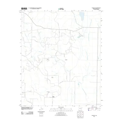
2011 Map of Fouke SE
USGS Topo · Published 2011About this map
The Fouke Oil Field and the meandering waters of the Old Channel McKinney Bayou define the landscape of south Miller County in this early 21st-century survey. The terrain is a network of small creeks and branches, including Beech Creek and the Holly Springs Branch, which feed into local catchments like Hensley Lake and Fish Lake. This area south of Fouke is marked by its small family and community cemeteries, such as McKenzie Cemetery, Phylaw Cemetery, and the Rocky Mound Cemetery, providing a clear map of local genealogy and settlement patterns. The presence of the Rocky Mound settlement and its namesake topographic feature suggests a long history of occupation in this drainage basin, while the extensive grid of county roads, including Mound Cemetery Rd and Williams Rd, reflects the modern rural infrastructure supporting both agriculture and the local petroleum industry.
Find a feature on this map
38 named features on this map. Tap any name to fly to it.
Don’t see what you’re looking for? This feature index may not catch every label — zoom into the map to look around manually.
Map Details
Editions of this 2011 Fouke SE Map
This is the sole edition of this map. No revisions or reprints were ever made.
Other maps of this area

1952 · Mandeville
USGS Topo · 1:24,000

1952 · Garland
USGS Topo · 1:24,000

1952 · Doddridge NW
USGS Topo · 1:24,000

1952 · Fouke SE
USGS Topo · 1:24,000

1952 · Doddridge NE
USGS Topo · 1:24,000

1952 · Fouke
USGS Topo · 1:24,000

1952 · Canfield
USGS Topo · 1:24,000

1952 · Fouke NE
USGS Topo · 1:24,000

1952 · Boyd Hill
USGS Topo · 1:24,000

1953 · El Dorado
USGS Topo · 1:250,000