
1952 Map of Canfield
USGS Topo · Published 1953About this map
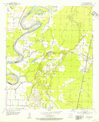
The Red River meanders sharply through this 1950s landscape, creating complex oxbows and cutoffs along the Miller and Lafayette County line. The river's historical path is recorded through named loops like Dillard Bend and Dixon Bend, illustrating a dynamic riparian environment controlled by various levees and drainage projects like Tull Ditch. Settlements are concentrated on the higher ground of Roane and Mars Hill, where the local community life centers around Union Hill Ch and its accompanying Union Hill Cem.
Find a feature on this map
26 named features on this map. Tap any name to fly to it.
Don’t see what you’re looking for? This feature index may not catch every label — zoom into the map to look around manually.
Map Details
Editions of this 1952 Canfield Map
4 editions found
Other maps of this area

1952 · Doddridge SE
USGS Topo · 1:24,000

1952 · Bradley
USGS Topo · 1:24,000

1952 · Garland
USGS Topo · 1:24,000

1952 · Fouke SE
USGS Topo · 1:24,000

1952 · Bradley NE
USGS Topo · 1:24,000

1952 · Doddridge NE
USGS Topo · 1:24,000

1952 · Lewisville
USGS Topo · 1:24,000

1952 · Bradley SE
USGS Topo · 1:24,000

1953 · El Dorado
USGS Topo · 1:250,000

1957 · El Dorado
USGS Topo · 1:250,000