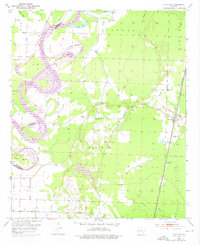
1952 Map of Canfield
USGS Topo · Published 1976About this map
The Red River creates a dynamic western boundary for this portion of Lafayette County, defined by dramatic oxbows and abandoned meanders like Dillard Bend and Dixon Bend. These hydrological shifts shaped the local geography and political boundaries, notably where the Miller Co Lafayette Co line follows older river paths. Inland from the floodplains, the landscape rises toward Steel Hill and Marsh Hill, providing higher ground for early structures like the Union Hill Ch and its neighboring Union Hill Cem.
Find a feature on this map
26 named features on this map. Tap any name to fly to it.
Don’t see what you’re looking for? This feature index may not catch every label — zoom into the map to look around manually.
Map Details
Editions of this 1952 Canfield Map
4 editions found
Other maps of this area

1952 · Doddridge SE
USGS Topo · 1:24,000

1952 · Bradley
USGS Topo · 1:24,000

1952 · Garland
USGS Topo · 1:24,000

1952 · Fouke SE
USGS Topo · 1:24,000

1952 · Bradley NE
USGS Topo · 1:24,000

1952 · Doddridge NE
USGS Topo · 1:24,000

1952 · Canfield
USGS Topo · 1:24,000

1952 · Lewisville
USGS Topo · 1:24,000

1952 · Bradley SE
USGS Topo · 1:24,000

1953 · El Dorado
USGS Topo · 1:250,000