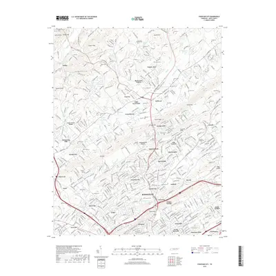
2019 Map of Fountain City
USGS Topo · Published 2019About this map
Knoxville and its northern suburban communities are captured in this topographical overview, where the ridge-and-valley topography of East Tennessee dictates the flow of development. The land is defined by prominent elevations like Copper Ridge and Sharp Ridge, which channel residential growth into corridors such as Hines Valley and Beaver Valley. The map highlights the transition from the denser street grids of Inskip and Whittle Springs near the city center to the established neighborhoods of Fountain City and the expanding northern settlements at Halls Crossroads.
Find a feature on this map
107 named features on this map. Tap any name to fly to it.
Don’t see what you’re looking for? This feature index may not catch every label — zoom into the map to look around manually.
Map Details
Editions of this 2019 Fountain City Map
This is the sole edition of this map. No revisions or reprints were ever made.
Other maps of this area

1886 · Knoxville
USGS Topo · 1:125,000

1892 · Knoxville
USGS Topo · 1:125,000

1893 · Briceville
USGS Topo · 1:125,000

1894 · Knoxville
USGS Topo · 1:125,000

1895 · Loudon
USGS Topo · 1:125,000

1895 · Briceville
USGS Topo · 1:125,000

1895 · Knoxville
USGS Topo · 1:125,000

1896 · Briceville
USGS Topo · 1:125,000

1897 · Maynardville
USGS Topo · 1:125,000

1900 · Maynardville
USGS Topo · 1:125,000