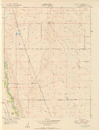
1950 Map of Fountain SE
USGS Topo · Published 1950About this map
Fountain Creek flows along the western edge of this territory, marking a distinct corridor of development in the high plains south of Colorado Springs. The landscape is defined by its ranching heritage and the movement of resources, notably evidenced by the Denver and Rio Grande Western railroad line and a significant Underground Pipeline cutting diagonally across the quadrangle. Sparse but established homesteads such as Hammer Ranch, Williams Ranch, and Totten Ranch anchor the rural landscape, highlighting the family-based agricultural settlement of the mid-century era.
Find a feature on this map
14 named features on this map. Tap any name to fly to it.
Don’t see what you’re looking for? This feature index may not catch every label — zoom into the map to look around manually.
Map Details
Editions of this 1950 Fountain SE Map
2 editions found
Other maps of this area

1891 · Pueblo
USGS Topo · 1:125,000

1891 · Nepesta
USGS Topo · 1:125,000

1893 · Nepesta
USGS Topo · 1:125,000

1893 · Big Springs
USGS Topo · 1:125,000

1893 · Colorado Springs
USGS Topo · 1:125,000

1894 · Pueblo
USGS Topo · 1:125,000

1896 · Pueblo
USGS Topo · 1:125,000

1897 · Pueblo
USGS Topo · 1:125,000

1904 · Nepesta
USGS Topo · 1:125,000

1909 · Colorado Springs
USGS Topo · 1:125,000