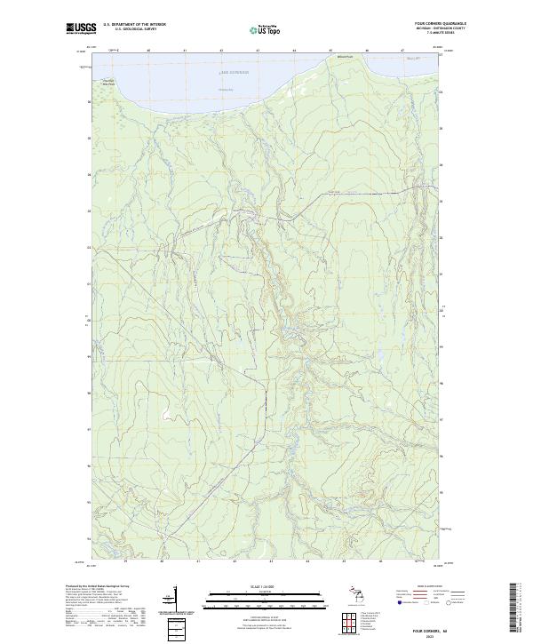
2023 Map of Four Corners
USGS Topo · Published 2023About this map
Lake Superior dominates the northern edge of this Ontonagon County landscape, where the shoreline is punctuated by Fourteen Mile Point and Willard Point. This coastal region is defined by a dense network of watercourses, including the West Sleeping River, East Sleeping River, and the Firesteel River, which drain toward Sleeping Bay and Misery Bay. The interior terrain is marked by seasonal and recreational access routes like Camp 18 Rd and several Snowmobile Logging tracks, reflecting a landscape centered on timber resources and winter transit. The drainage patterns of Holland Creek and McCarthy Creek illustrate the heavily dissected topography typical of the Upper Peninsula, while the Little Misery River winds through the northeastern corner. This modern survey provides a detailed look at the hydrology and trail systems that support current land management in this remote stretch of Michigan.
Find a feature on this map
20 named features on this map. Tap any name to fly to it.
Don’t see what you’re looking for? This feature index may not catch every label — zoom into the map to look around manually.
Map Details
Editions of this 2023 Four Corners Map
This is the sole edition of this map. No revisions or reprints were ever made.
Other maps of this area

1950 · Greenland
USGS Topo · 1:62,500

1951 · Greenland
USGS Topo · 1:62,500

1954 · Rockhouse Point
USGS Topo · 1:24,000

1954 · Winona
USGS Topo · 1:62,500

1958 · Hancock
USGS Topo · 1:250,000

1958 · Iron River
USGS Topo · 1:250,000

1960 · Iron River
USGS Topo · 1:250,000

1960 · Hancock
USGS Topo · 1:250,000

1961 · Iron River
USGS Topo · 1:250,000

1961 · Hancock
USGS Topo · 1:250,000