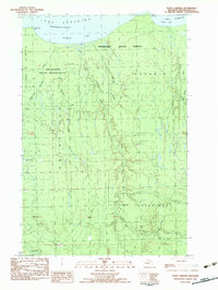
1982 Map of Four Corners
USGS Topo · Published 1983About this map
The Ontonagon Indian Reservation and Mishwabic State Forest dominate this coastal landscape along the southern shore of Lake Superior. Surveyed in the late 1970s and published as a provisional edition, the map reveals a remote terrain defined by its logging and seasonal camps rather than established towns. These outposts, including Penegors Camp, Hilger Camp, and Old Hilger Camp, are scattered across the dense forest and drainage basins of the Sleeping River and East Sleeping River.
Find a feature on this map
28 named features on this map. Tap any name to fly to it.
Don’t see what you’re looking for? This feature index may not catch every label — zoom into the map to look around manually.
Map Details
Editions of this 1982 Four Corners Map
This is the sole edition of this map. No revisions or reprints were ever made.
Other maps of this area

1950 · Greenland
USGS Topo · 1:62,500

1951 · Greenland
USGS Topo · 1:62,500

1954 · Rockhouse Point
USGS Topo · 1:24,000

1954 · Winona
USGS Topo · 1:62,500

1958 · Hancock
USGS Topo · 1:250,000

1958 · Iron River
USGS Topo · 1:250,000

1960 · Iron River
USGS Topo · 1:250,000

1960 · Hancock
USGS Topo · 1:250,000

1961 · Iron River
USGS Topo · 1:250,000

1961 · Hancock
USGS Topo · 1:250,000